
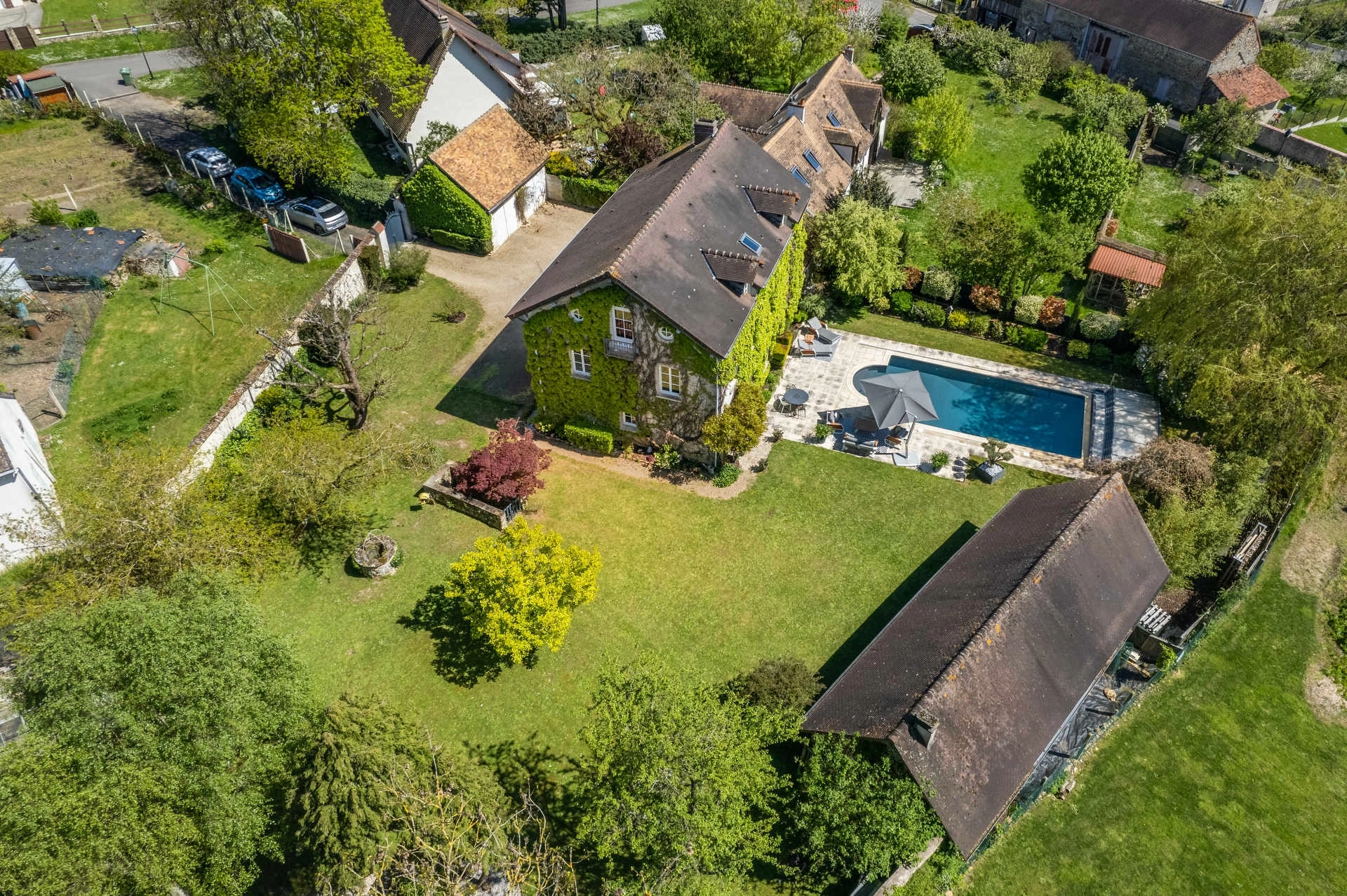
On the ground, a photographer can sublime a facade or an interior. But for a property located in the countryside, boasting a large park or an exceptional view, traditional photography shows its limits. How can you prove the absence of neighbors? How do you show the true extent of the land?
Drone photography is not a mere technological gimmick. It is the only tool capable of changing scale to reveal the property’s layout and its anchoring within the landscape.
Showing What the Eye Can’t See: Vastness and Calm
The number one selling point for a country house or an isolated villa is tranquility. An aerial photo provides irrefutable proof: it shows the distance from the road, the proximity to a forest or a stream, and above all, the total lack of overlooking neighbors.
It is a visual “map” that speaks volumes more than a cadastral plan. For luxury real estate, where you are primarily selling a living environment and privacy, this elevated view is indispensable to trigger a qualified viewing.
Architecture Seen from Above (The 5th Facade)
Architects often call the roof the “5th facade.” The drone allows viewers to appreciate the complexity of the volumes, the quality of a renovated roof, or the harmonious layout of outbuildings.
It is also the ideal angle to highlight leisure spaces. As I mention in my article on pools and spas, a plunging view instantly conveys the ratio between the swimming area, the terrace, and the garden.
Why I Favor Rural Areas (Safety and Regulations)
Drone usage in France is strictly regulated by the Civil Aviation Authority (DGAC). Contrary to popular belief, you cannot fly just anywhere.
In dense urban areas, flights require complex protocols and heavy administrative authorizations to ensure public safety. That is why I focus my aerial photography services on rural areas and large private estates. This allows me to fly perfectly legally (in the “Open” category), without endangering third parties, and deliver images to you with complete peace of mind. Furthermore, it is exactly in these open environments that the drone brings its greatest aesthetic added value.
More Than a Photo: Setting the Context
Be careful: getting altitude does not mean climbing to 300 feet! Often, the most beautiful images are taken at 30 to 50 feet above the ground. This is called a “mast-height” view. It provides a magnified human perspective, allowing you to look over a hedge or a gate while maintaining a connection with the ground. Naturally, these flights are highly dependent on weather conditions (see my approach to bad outdoor weather).
Conclusion
If you are selling a “living environment” rather than mere walls, aerial photography is a major asset. It tells the complete story of the location and its surroundings.
Do you have a property with extensive land to showcase? Let’s check the flight feasibility together.